The Atlantic Basin is waking up after an almost three-week slumber. After Gabrielle, we're watching two more tropical waves for development. Here's the latest.
Even the atmosphere hits roadblocks sometimes, and this week’s forecast is a great example of an atmospheric weather pattern known as a Rex blocking pattern.
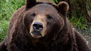
One of the best weeks of the year for animal-lovers is finally here. Fat Bear Week is back to celebrate all that chomping and chowing down the brown bears have been up to in Katmai National Park over the past few months. Whichever bear is deemed the fattest and most successful heading into hibernation will be crowned Fat Bear Week Champion. And you get to help decide! Head to explore.org to cast your vote.